Precision Point Cloud Conversion
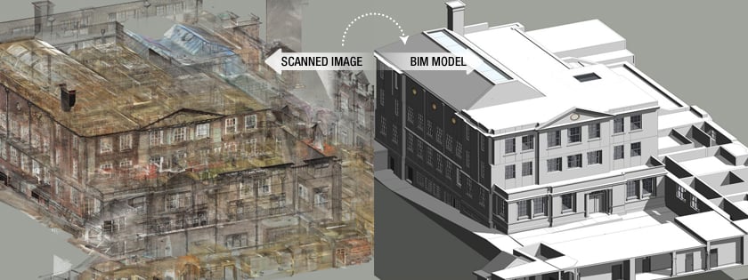
At GeoSystems, we specialize in converting high-resolution point clouds, collected by our advanced laser scanners, into comprehensive BIM-ready and CAD formats. Our services include creating detailed Revit models and AutoCAD drawings, ensuring that your projects are based on accurate and reliable data.
Benefits of Our Scan-to-BIM Workflow:
- Accuracy: Achieve precise models that reflect the real-world conditions of your project site.
- Efficiency: Accelerate project timelines by reducing the need for multiple site visits.
- Informed Decision-Making: Empower your engineering teams and project designers with accurate, up-to-date models for better planning and execution.
- Versatility: Suitable for various applications, including architectural design, structural analysis, and MEP (Mechanical, Electrical, and Plumbing) coordination.
Our complete and accurate scan-to-BIM workflow enables engineering firms and project designers to make informed decisions quickly, enhancing project outcomes and optimizing resources.
Contact us today to learn more about how our Scan to CAD & Scan to BIM services can benefit your next project.


